Friday, September 17, 2021

Eastern Oregon Part II

 We've always been fascinated by ghost towns.  Seeing what remains today and trying to visualize what they looked liked in their heyday is always interesting, especially when you can read the history of the towns and find old photographs.  We read about the town of Cornucopia, an old mining town, and decided to check it out.

On our way east to visit the town, we stopped at the Oregon Trail Visitors Center, a BLM facility that sits next to the trail and has a large interpretive center.  Which, since it is a federal facility, was closed.  We walked along the trail but didn't venture down to the wagon ruts themselves since the temperature was over 90 and the return would be a lengthy uphill walk.  There was little to see without the center being open and the heat was fierce, so we decided to head for Cornucopia.

We followed the highway east from the visitor center as it followed a creek through canyons and desert until reaching the small town of Halfway.  From there, we headed north on a dirt road into Cornucopia. 

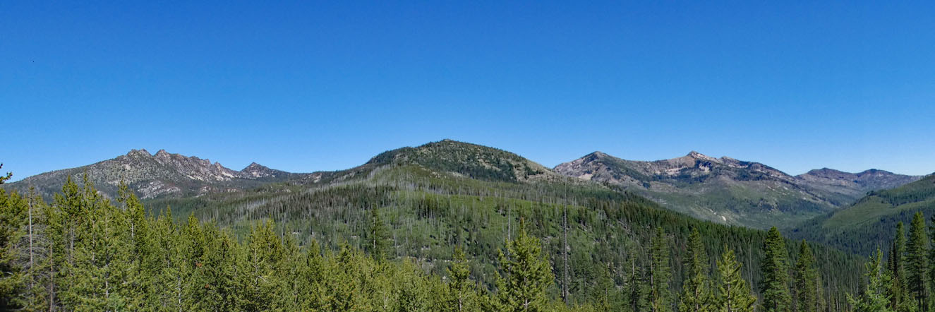
Cornucopia sits in a 4700' narrow valley surrounded by steep mountains on three sides.  This is the "backside" of the Wallowa Mountains, a rugged, heavily forested area.  Following the dirt road into the former townsite we saw what has become a typical "ghost town" - fallen remains of buildings, buildings barely standing, and others that have been fully or partially restored and are occupied during the summer.  

Road to Cornucopia

The town was named after a mine opened in 1884 and the successful mining of gold led to a population growth of around 700 residents by 1902.  This was a tough place to live; the alpine environment meant extremely hard winters with snowfall measured in the tens of feet.  Still, the mine continued to operate until 1929 when the stock market crashed, dropping the population to 10.  It had a short revival when more efficient mining equipment was introduced, but WWII was a death knell for the town, and after over $4M in gold was extracted from the many tunnels under the town, the mine shut down.  

Cornucopia Town Site

Navigating over rough gravel and dirt roads, buildings became visible.  Top left is what was probably a miner's dormitory, bottom left is the original jail, to the right a restored and occupied home.


There are many photos available that show the town in the days it was booming:


The winters were long and harsh:


A short distance from the town site is the Cornucopia Lodge and Pack Station, a modern lodge that serves as a starting point for those exploring the Eagle Cap Wilderness and for cross country skiing in the winter. 

Besides lodging, it has a snack bar, large living area with fireplace, and the only WiFi in the area.  We talked to the lady manager who told us that she and her husband live there year around.  During the winter it sometimes resembles living in the lodge from "The Shining" but so far, without the ghosts.  When asked how she could tolerate the snow and cold, she told us that she was from Stanley, ID, reputed to be the coldest town in the lower 48.  We remember visiting there one summer - it was easy to tell which residents lived there year around; their stack of firewood was higher than the roofs of their houses!

It's a beautiful place in winter: 


Even though they stock up on supplies, they still have to make an occasional trip to Halfway.  And it's only possible because of their really cool and appropriately named Yukon!


Our next stop was a week in amazing Joseph, a scenic town tucked into the northern side of the Wallowa Mountains.  We'll be posting soon so check back!

Saturday, September 04, 2021

Eastern Oregon, Part I

If you've never spent time there, when you think of Oregon you might think of Portland (and it's constant political turmoil), Crater Lake, and the scenic coastline.  And while the Oregon Coast and the Cascades are stunning, there's a lot more to Oregon, especially the overlooked Eastern half.

Oregon from Bend eastward is a combination of mountains and desert, forest and sagebrush.  From the top of Steen's Mountain to the banks of the Snake River is nearly 8000' difference in elevation, and there's a lot of places in between.  On our journey, our first stop eastward was the little town of John Day.

We've stopped here before and enjoyed our visits.  There's a small, tree-shaded RV park next to the fairgrounds on the bank of the John Day River.  It's a great place to stay while exploring the area.

Located at the base of the Strawberry Mountains, John Day was settled in the early 1860s as a mining town.  In 1880 the official population was 280, but this number didn't include the estimated 1000 Chinese, all men, who worked as miners.  Today the Chinese population is gone; the population is around 1500 and slowly decreasing.  

We visited friends Robin and Donna who were volunteering as camp hosts high in the mountains at Magone Lake, drove the backroads of the Strawberry Mountains, and visited the interesting Kam Wah Chung Museum.

The Kam Wah Chung and Company ("Golden Flower of Prosperity") was a Chinese-owned grocery, dry goods store, and clinic, built in 1866 to serve the large Chinese population.  It also functioned as a temple and joss house, unofficial post office, library, business and interpretive center, contract labor pool, social club, dormitory, and apothecary shop. One of the partners, Ing Hay was a "herbalist" who became known as "Doc Hay" and continued living in Kam Wah Chung until his death in 1955.  He became the primary medical provider to many in the town, and was a popular member of the community.


Because the original building was closed due to COVID, the visitor center staff had developed a "virtual" tour.  We sat in front of a large screen while the host took us through each room, examined each shelf and item, and explained what we were seeing.  The display was amazing, and as the host explained, the virtual tour allowed visitors to see far more than a physical visit.


From John Day, we traveled east for a week's stay at the Mountain View RV Park in Baker City.  With views of the Elkhorn Mountains to the west and the Wallowa Mountains to the east, Baker City is one of Oregon's most picturesque towns.  Sitting on the historic Oregon Trail, the town's main street reflects it's heritage as a major stop for thousands of travelers.  


Baker City was a place where we could comfortably stay and use it as a base to explore the area.  Our first visit was to the Sumpter Dredge, about 30 miles into the mountains.  We've seen dredges before, and it always amazes us that these huge machines could move up a stream-sized river while excavating for gold.  The dredge is huge - the boom alone has 72 one-ton buckets!


The dredge was basically a big sluice box and only needed three men to operate it; however, another 17 were needed for support (maintenance, admin, etc.).  Although the dredge made $4.5 million during it's lifetime, it lost money and was shut down in 1954.  The interior was immense with all kinds of motors, belts, pulleys, and chutes going in all directions.  I have no idea how it all worked, but it must have been noisy!


We continued past the dredge along the Elkhorn Scenic Byway, a 106-mile loop that took us through the mountain gold country and back to Baker City.  It's a beautiful area of high mountains and forest:


We visited the nearly-ghost town of Granite, a gold mining town that was shut down during WWII.  The population in 1960 was one lone occupant, but it's been exploding with growth and now has a population of 40.  Most of the buildings are abandoned, but some have been partially restored and are occupied.


Throughout the area we could see mining tailings - they're everywhere along the road and well into the forest.  There are also areas that look like tailing from a dredge, but were created when hundreds of Chinese miners moved and stacked rocks to expose the water underneath.  It's difficult to visualize, but these mountain areas teemed with miners and small settlements drawn to the lure of gold.  And just as fast as they appeared, they disappeared when the gold ran out.


As we continued on the byway, the tailings disappeared as we drove into a rugged area of mountains.  We passed Anthony Lakes, a resort area with golf course and ski resort.  Overlooking the area is Gunsight Mountain, aptly named when you look at the summit.

Eventually we turned east and descended back into the valley and Baker City.  We truly enjoyed our visit to Baker City and the surrounding area, but it was time to move on.  Check back with us for Eastern Oregon, Part II!